File:Blue elephant truck in Don Det.jpg

Original file (6,089 × 4,059 pixels, file size: 4.84 MB, MIME type: image/jpeg)
Captions
Captions
Summary
[edit]DescriptionBlue elephant truck in Don Det.jpg |
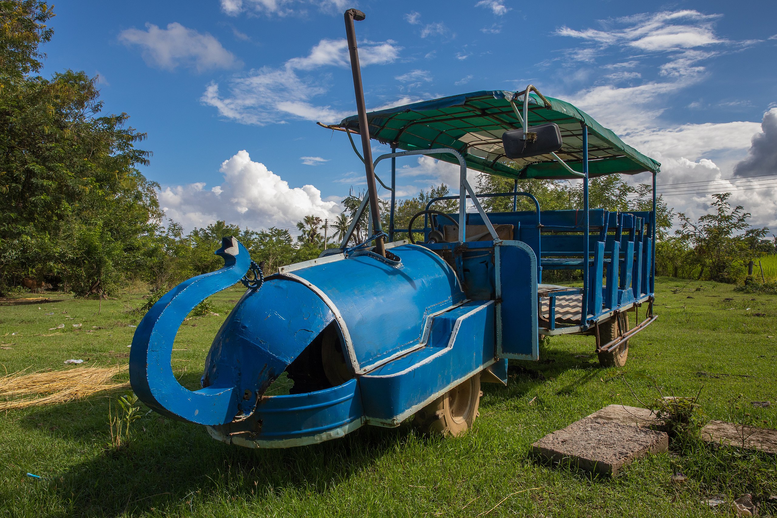
English: Blue songthaew truck shaped with an elephant trunk in Don Det, Laos.
Français : Camion bus bleu designé avec une trompe d'éléphant à Don Det, Laos. |
Date | |
Source | Own work |
Author | Basile Morin |
Camera location | 13° 58′ 53.02″ N, 105° 55′ 27.3″ E ![]() | View this and other nearby images on: OpenStreetMap | ![]() |
---|
Licensing
[edit]


- You are free:
- to share – to copy, distribute and transmit the work
- to remix – to adapt the work
- Under the following conditions:
- attribution – You must give appropriate credit, provide a link to the license, and indicate if changes were made. You may do so in any reasonable manner, but not in any way that suggests the licensor endorses you or your use.
- share alike – If you remix, transform, or build upon the material, you must distribute your contributions under the same or compatible license as the original.
![]() |
This image has been assessed using the Quality image guidelines and is considered a Quality image.
العربية ∙ جازايرية ∙ беларуская ∙ беларуская (тарашкевіца) ∙ български ∙ বাংলা ∙ català ∙ čeština ∙ Cymraeg ∙ Deutsch ∙ Schweizer Hochdeutsch ∙ Zazaki ∙ Ελληνικά ∙ English ∙ Esperanto ∙ español ∙ eesti ∙ euskara ∙ فارسی ∙ suomi ∙ français ∙ galego ∙ עברית ∙ हिन्दी ∙ hrvatski ∙ magyar ∙ հայերեն ∙ Bahasa Indonesia ∙ italiano ∙ 日本語 ∙ Jawa ∙ ქართული ∙ кыргызча ∙ 한국어 ∙ kurdî ∙ Latina ∙ Lëtzebuergesch ∙ lietuvių ∙ македонски ∙ മലയാളം ∙ मराठी ∙ Bahasa Melayu ∙ Nederlands ∙ Norfuk / Pitkern ∙ polski ∙ português ∙ português do Brasil ∙ qaraqalpaqsha ∙ rumantsch ∙ română ∙ русский ∙ sicilianu ∙ slovenčina ∙ slovenščina ∙ shqip ∙ српски / srpski ∙ svenska ∙ தமிழ் ∙ తెలుగు ∙ ไทย ∙ Tagalog ∙ toki pona ∙ Türkçe ∙ українська ∙ Oʻzbekcha ∙ vèneto ∙ Tiếng Việt ∙ 中文 ∙ 中文(简体) ∙ 中文(繁體) ∙ +/− |
File history
Click on a date/time to view the file as it appeared at that time.
Date/Time | Thumbnail | Dimensions | User | Comment | |
---|---|---|---|---|---|
current | 04:32, 25 January 2018 | ![]() | 6,089 × 4,059 (4.84 MB) | Basile Morin (talk | contribs) | User created page with UploadWizard |
You cannot overwrite this file.
File usage on Commons
The following 6 pages use this file:
- User talk:Basile Morin/Archive 2
- Commons:Photo challenge/2018 - January - Blue
- Commons:Photo challenge/2018 - January - Blue/Voting
- Commons:Photo challenge/2018 - January - Blue/Voting/Result
- Commons:Quality images/Subject/Objects/Transport and Vehicles/Other vehicles
- Commons:Quality images candidates/Archives January 28 2018
File usage on other wikis
The following other wikis use this file:
- Usage on vi.wikipedia.org
Metadata
This file contains additional information such as Exif metadata which may have been added by the digital camera, scanner, or software program used to create or digitize it. If the file has been modified from its original state, some details such as the timestamp may not fully reflect those of the original file. The timestamp is only as accurate as the clock in the camera, and it may be completely wrong.
Camera manufacturer | Canon |
---|---|
Camera model | Canon EOS 5D Mark IV |
Author | Basile Morin |
Copyright holder | Basile Morin |
Exposure time | 1/250 sec (0.004) |
F-number | f/13 |
ISO speed rating | 400 |
Date and time of data generation | 14:41, 4 October 2017 |
Lens focal length | 25 mm |
Latitude | 13° 58′ 53.02″ N |
Longitude | 105° 55′ 27.3″ E |
Altitude | 88.1 meters above sea level |
City shown | Khon Tai |
Horizontal resolution | 233 dpi |
Vertical resolution | 233 dpi |
Software used | Adobe Photoshop Lightroom 6.12 (Windows) |
File change date and time | 16:24, 23 January 2018 |
Exposure Program | Manual |
Exif version | 2.3 |
Date and time of digitizing | 14:41, 4 October 2017 |
APEX shutter speed | 7.965784 |
APEX aperture | 7.400879 |
APEX exposure bias | 0 |
Maximum land aperture | 3 APEX (f/2.83) |
Metering mode | Pattern |
Flash | Flash did not fire, compulsory flash suppression |
DateTimeOriginal subseconds | 68 |
DateTimeDigitized subseconds | 68 |
Color space | sRGB |
Focal plane X resolution | 1,866.6666564941 |
Focal plane Y resolution | 1,866.6666564941 |
Focal plane resolution unit | 3 |
Custom image processing | Normal process |
Exposure mode | Manual exposure |
White balance | Auto white balance |
Scene capture type | Standard |
GPS time (atomic clock) | 07:41:44.906 |
Satellites used for measurement | 8 |
Receiver status | Measurement in progress |
Measurement mode | 3-dimensional measurement |
Measurement precision | Fair (1.9) |
Geodetic survey data used | WGS-84 |
GPS date | 4 October 2017 |
GPS tag version | 0.0.3.2 |
IIM version | 4 |
Keywords |
|
Province or state shown | Champasak Province |
Code for country shown | LA |
Country shown | Laos |
Structured data
Items portrayed in this file
depicts
13°58'53.022"N, 105°55'27.300"E
4 October 2017
image/jpeg
9f6b5466a2aedba01276681d78c08f538853ef20
5,077,736 byte
4,059 pixel
6,089 pixel
0.004 second
13
400
25 millimetre
- Files with coordinates missing SDC location of creation
- CC-BY-SA-4.0
- Self-published work
- Photographs by Basile Morin
- Taken with Canon EOS 5D Mark IV and Canon EF 24-70mm F2.8L II USM
- Quality images of Champasak Province
- Quality images by Basile Morin
- Quality images of trucks
- Quality images by Basile Morin/Objects
- Quality images
- Quality images missing SDC depicts
- Laos photographs taken on 2017-10-04